This page contains a high-level overview of in-house prototype apps used by the WSWC and the WaDE team to demonstrate and guide the development of the WaDE 2.0 system and its accompanying Western States Water Data Access and Analysis Tool (WestDAAT). WestDAAT’s first stage focuses on water rights data. These prototypes serve as a demonstration for Stage 2 of WestDAAT. Each prototype focuses on a unique type of data (e.g., aggregated budget, site-specific time series, reservoirs, and gages observation site data, etc.) being explored and entered into the WaDE database. These in-house prototypes illustrate proof of concept and help portray what we envision as the end goal of WaDE 2.0 and what it can accomplish for its users. Our member states provided data used by these prototypes and represent the ongoing coordination between state agencies and the Western States Water Council.
As a warning, these prototypes and their accompanying data are not for public use and have not fully been approved by our member states as the work we do is an iterative process with our member states. They are for demonstration use only to provide a roadmap of the direction we are taking in the development of WaDE and WestDAAT tools. In addition, it is important to note that individual state agencies use separate methods to estimate water use data. We casuin against making water use comparisons across state lines due to the different methods our states follow. Before drawing any conclusions or making comparisons at this time, be sure to consult with the state agency.
Overlays Information
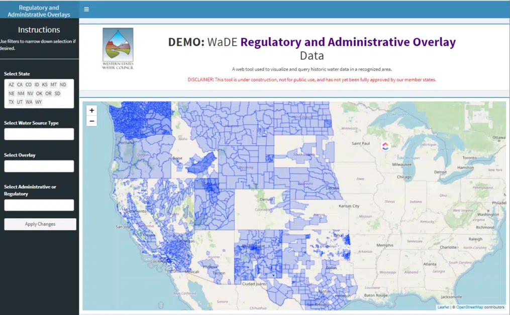
There are regulations, compacts, special management areas, etc. that provide a overlay framework for water supply and water use across each state in the West. Examples of use cases that involve regulatory/institutional constraints include:
- What statues, special management areas, regulatory oversight, compacts, or laws are involved in regulation of water supply or water use in a given reporting unit in any member state? More interestingly, how does these boundaries interact as state boundaries? Are regulations continuous or fragmented across state lines?
- What are the extents (i.e., affected reporting units) that coincide with a regulatory/institutional constraint of interest?
Aggregated Water Budget Preview
(click image to view)
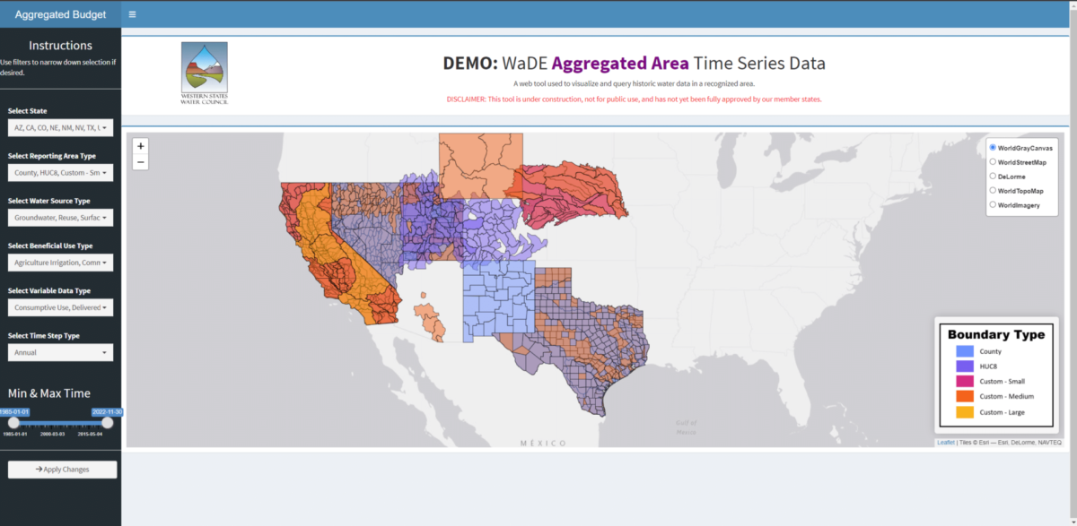
Aggregated water use, supply, and transfers may be estimated or calculated from user-reported data over-reporting units (i.e. water budgets). A water resource agency’s water budget estimate is most often estimated annually with a one-year lag time. Water budgets within a basin have historically been categorized by both withdrawals (i.e., how much water was taken from a stream, spring, or reservoir) and consumptive use (i.e., how much water was used or depleted by the application of the water withdrawal). Examples of aggregated water use case questions can include the following:
- What is the annual water budget for a given year in a given area?
- What is the annual water budget, beneficial use categories, water source types, and estimation methods for a given area?
Public Supply Water Use Preview
(click image to view)
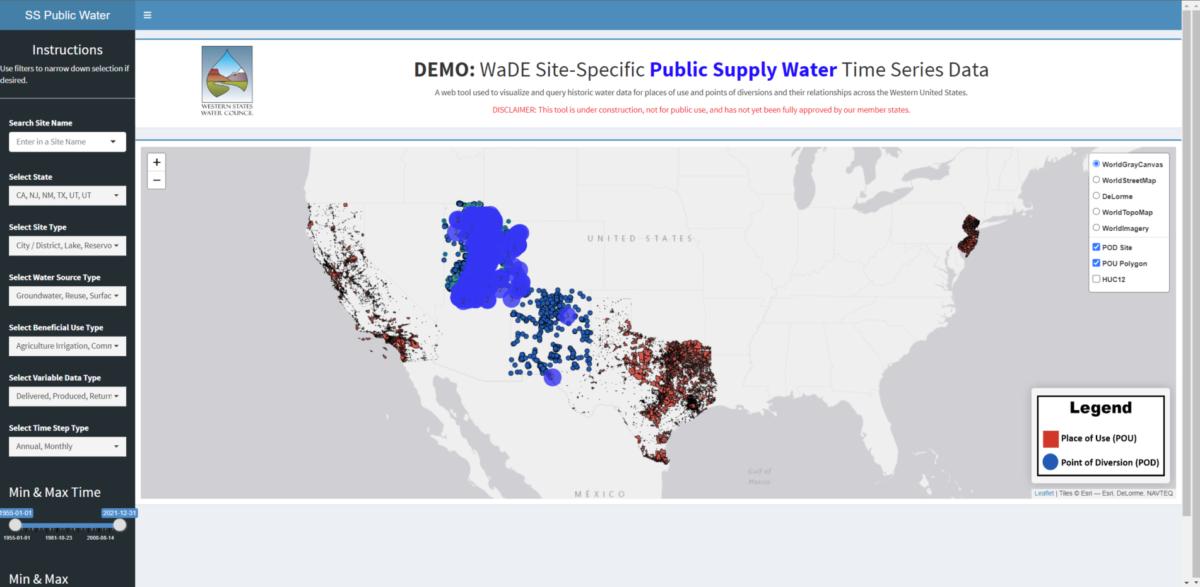
Water is withdrawn from site-specific locations and then applied (i.e., depleted) at a different location. Put another way, a water right may have one or more points of diversion which may in turn have one or more places of use, which may in turn, have many return flows (i.e., discharges back to the natural hydrologic system). Examples of site-specific water use case questions can include the following:
- Where are related points of diversion/return and their actual amounts values in a hydrologic system?
- What is the annual time series for a given set of sites with a known beneficial use category, water source type, and/or methodology?
Water Supply Information Preview
(click image to view)
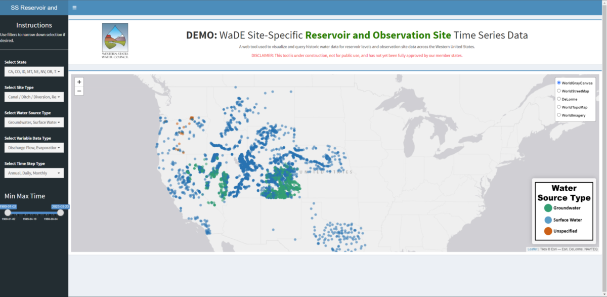
Knowing river and reservoir status can help with long-term planning and flood forecasting modeling. Two relative measurements often used are discharge and gage height. Discharge is the rate at which a volume of water passes by a particular location. Gage height is a measurement of the distance between the water’s surface above the stream gage’s datum reference point (i.e., a unique reference point used to accommodate for changes in a stream channel over time). Examples of reservoir and gages water use case questions can include the following:
- What are the real-time responses that can be made with changing gauge heights?